Wednesday, May 29, 2013

Intracoastal Waterway - Dolphins and Bear!!!

For us to satisfy our insurance company we have to be north of Cape Harratas by the 1st of June which is the official start of the hurricane season. Our initial landfall at Morehead city is not north of this point but from here we can head North on the Intracoastal Waterway (ICW) which is a series of rivers, creeks, canals and sounds which run along the east coast from Virginia to Florida all protected from the atlantic ocean.  We had 200 miles to transit in this way to reach Chesapeake although once halfway we would be north of the imaginary hurricane safe zone.

Day 1  – We were not quite sure what to expect, we had some paper charts which were kindly given almost a year ago in Corsica (thanks Peter and Sue) and had spoken to a few people about their trip but our knowledge was limited. We also had a problem with a brand new memory card which contained all our electronic charts for this area, it was blank! So we were doubly grateful for the paper charts and also to a Canadian guy (think he was called Alan) we met in Sint Maartin who decided to hop aboard one day to copy a navigation program, charts and software to allow my handheld GPS to interact with our PC. We never did find out his name, he just asked if we had the program and charts, we said no, so he returned and gave them to us. Whoever you are, many thanks they have been invaluable.

As we left Morehead City to join the first canal we were slightly surprised to see a stream of sail and power boats already heading in the same direction! 

Start of ICWon a grey May morning
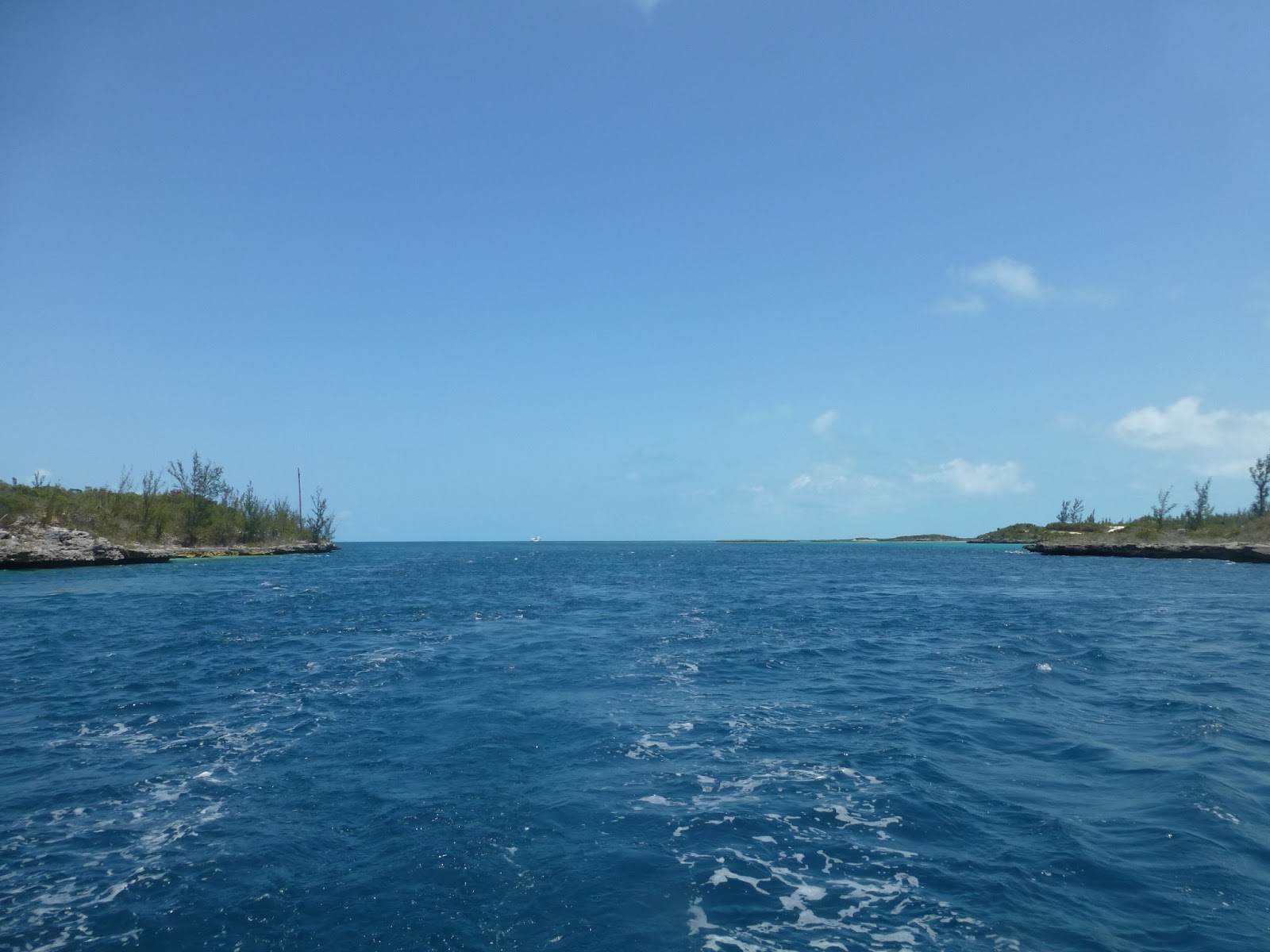
It was a grey day as we entered the Adams creek canal which was about a quarter of a mile wide surrounded by marshland. As we motored along the heavens opened but this couldn’t dampen our spirits as it was such a new adventure!

An excited Mark

We were still of the outskirts of Beaufort and they were some impressive properties lining the canal, they even looked lovely in the rain!


We motored along the canal hoping from buoy to buoy for 15 miles before reaching the river Neuse which was a large expanse of water but still there is a very clear channel that you need to follow as even the river is often too shallow for Magnum but there was slightly more room to manoeuvre and we were even able to sail for some of the 25 miles.  The shore here is still lined with some spectacular properties dotted in the woodland and there is  the town of Oriental is on the north shore but generally it still feels like you are in the wilderness with the shore lined with hundreds of huge trees which look like they go on for miles.  Although we had left in a flurry of boats we only passed a handful of boats and apart from the annoyance of the engine it was amazingly peaceful.

Following the river the channel again narrowed off into Goose Creek.  Here we had our 2nd surprise visit of the day from dolphins! This really was the last thing we expected in the shallow, very murky water of the ICW, they were bottled nose dolphins and were happy to pop over to say hello.


This made for a nice end to the day, a few miles up Goose creek, we found a small deep pool where we could pull out of the channel to anchor for the night, we were still a little concerned about depths and the accuracy of the chart which we were using from our laptop, so we edged over a much as we dared and threw the anchor over.  It all felt very remote with just a few houses on the shore but just as we were off to bed we heard a noise and Mark popped his head out of the hatch to see the biggest/longest barge we had ever seen less than 100 feet away motoring down the canal, wow glad we were out of the channel!

Day 2 – Up anchor by 7.10 as the wind was forecasted to increase in the afternoon, we were joined in the early morning by the fishing men visiting their buoys – we assume they are crab pots.  

Little fishing boat in middle of photo, lovely surrounding houses

A few mile along Goose Creek we were out into Pimlico River, this seemed huge, it was probably around 5 Miles across, to the west we could see a road bridge crossing the river but still the majority of the shoreline is lined with trees and no sign of civilisation.  Good news was we were able to sail some of the river as we had force 3 although we had to stick to our buoy hopping as there were various shoals and even the area in which we were sailing was only around 5 metres deep.  We sailed for 20 miles on the river before entering Alligator RiverPungo River Canal which is suddenly very narrow, at only about 100 metres wide but it is also lined with fallen trees and tree stumps where the shoreline is obviously eroding.


The boating traffic had been relatively quiet all morning suddenly we were inundated by power boats wanting to pass us.

Surrounded by powerboats

But it soon became quiet again as we continued to motor down the middle of canal on the constant look out for debris in the water.

There seemed to be a constant stream of giant butterflies almost bumping into Magnum on their flight across the canal and we were both feeling a bit itchy from being so close to the bugs! There were very few properties along this stretch of canal and even when Mark stood on the boom to get a better look it was just wilderness far into the distance.  We saw many birds of prey and the for us the best bit of the day was seeing a bear!!! We never even realised that there were bears in this area but there he/she was stood on the canal bank completely undisturbed by us even as Amanda shrieked with excitement.

An amazing Black bear
The day ended with a little too much excitement as we emerged from our 90 yard wide canal in the trees into a large expanse of open water and 35knts of wind which threw waves and spray at Magnum. It was a bit tense for a while because although we had miles of water all around the ICW is only a 90 yards wide channel dredged through the middle and the water either side is sometimes less than 2ft deep. Magnum is 7ft, so staying in the channel that we couldn’t see was very important !
We managed a couple of miles and then spotted, on the chart, a slightly deeper pool just off the channel (8ft) this offered some shelter so we inched our way in and dropped anchor.
An hour later the wind had calmed and we were serenaded by frogs in the swamp and the buzz of flying things……………


Tuesday, May 28, 2013

Bahamas to USA - Back into the Atlantic Swell


480 miles of open water to cross, passing through the Bermuda triangle, crossing the gulf stream and reaching America via the “graveyard of ships”
It all sounded a bit dramatic, but with a good long range forecast we set off. We didn't want to make landfall in the US in the dark so we tried to estimate our passage time, this was complicated by the unknown factor of the Gulf Stream which flows from Florida across the Atlantic to the west coast of the UK. Some predictions showed we may pick up 3-4 knts of favourable current if we could find it but it was quite a big IF.

Day one was a nice downwind sail in a F3/4, sunny and warm with a gentle swell. A slightly frustrating adverse current of about 1knt but the main issue we had was the amount of weed in the water which kept fouling our generator which we tow in the water, I was clearing it every half hour.

Day two and the wind steadily increased and we had some fast sailing, right up to the point we ran into a 2knt adverse current. We were obviously pretty near the gulf stream but so far had only picked up counter currents not the main event. Oh and more weed !

Day three we finally hit the warm water of the gulf stream, the water temperature was over 30 deg, but all that really happened was that the giant hand causing the current stirred and splashed at the water making in very uncomfortable but with very little in the way of positive current, very disappointing.

Our forth night at sea was pretty busy, we were approaching land so shipping increased, sandbanks and shallows had to be avoided and then as a finally we had 30knts of wind appear from nowhere and last couple of hours. Always in the dark at 2 in the morning and approaching land……..the law of sod !  But we were joined by some dolphins in the final hours.


Anyway we arrived at the Beaufort inlet in the morning, had a couple of interesting hours motoring slowly in against an ebb tide and were very grateful to tie up at the marina, hot showers, courtesy car for shopping and as much free fresh water as I wanted to finally rinse months of salt water from Magnum.

Clearing in was easier than expected, the marina let us use their phone and I gave details of passports, last port of call, cruising permit etc and then they arranged to come to the marina to finish the formalities. An hour later they were there, very efficient and friendly and we have been allow to stay until the end of the year.  

Final memories from the West Indies - a wonderful 4 months


Turtles – we had only ever had a brief sighting of a turtle in the past and there were many places that we were seeing turtles every day, how amazing! Each sight was as exciting as the first and to be in the water with one swimming beneath you is really cool.

Rum – Yep we have consumed a fair amount, dark rum, light rum, golden rum mmmm all yummy. Rum punches, Ti punch, dark and stormy, pina colada, killer bees, pain killers always up for trying something new.

Hummingbirds – Always wanted to see a hummingbird, so tiny and fast, after our first sighting in Guadeloupe we then saw regularly in the Lesser Antilles.

Snorkelling – There are some wonderful spots to snorkel on lots of the islands and once Amanda had overcome the fear of sharks we could enjoy the coral reefs. We must have seen over 50 species of reef fish, huge barracuda (as big as Amanda), giant stingrays and even a shark plus brightly coloured and delicate corals, it was like a garden under the sea!

Bananas – On arriving in Guadeloupe after almost 3 weeks at sea we made the most of our supermarket trips and were so impressed by the fact that we could eat local bananas, we thought how wonderful it would be to eat lots of fresh exotic local fruit but we soon realised this was not to be the case. As we transmitted the islands we realised that produce was not imported from local islands, so you could not find Guadeloupe bananas in Antigua even though they are neighbouring islands, you would get more variety of fruit and veg in the UK though all imported – how can this be right!

Rain Forest – Neither of us had every visited a rain forest, we were amazed by the size of the trees, the variety of plants, the vastness of the coverage and were still surprised when we were caught out in a huge downpour!

The colour of the sea – on many occasions we commented on the beautiful colour of the sea, turquoise, deep blue, green, aqua every shade of blue and green and often amazingly clear.

The people – we meet some really lovely people and mostly people were very friendly, not that often in the UK do you walk down the road and everyone say hello to you. It was often in the most remote and often poor locations that people made you feel this most welcome, funny that in the more touristy areas this is where you felt people tried to take advantage of you.

We have many special memories from our 4 months in the West Indies, not all the islands were the same and we enjoyed lots of different experiences.

Thursday, May 23, 2013

Abacos Cay - Marsh Harbour and Hope Town

We were back into the Atlantic rolling swells for our trip to the Abacos Cays which was fine for the first 5 hours but as the wind dropped off our sails started to flap, so it was engine on for the rest of the day which was a bit frustrating.  Even the tankers were suffering in the swells.


Big tankers bobbing in the swell
Next day the plan was to head for Man o War Cay, knowing that a strong northerly was on its way, so we needed to get shelter. This was not much more than 10 miles away but we had to motor most of it as we were weaving around sand banks, also we wanted to stop on route to attempt to get some wifi.  After around 5-6- miles we stopped close to a marina in the hope we would pick up wifi. We did and thanks to their generosity, unlocked broadband, Amanda called her mum and dad before they went on holiday.

So we upped anchor and headed back out to deeper water, but in under a minute we slid to a halt. Mark came running up from below to see what had happened. We had driven onto an unmarked sandbank and Magnum liked her new resting place as she seemed very reluctant to let go of her hold on the sand.
Quick action was required as the tide was falling and we could be marooned here until the next high tide about 9 hours later.
We tried reversing off the way we had come......nope,
we tried going forward hoping it was a small raised patch of sand........nope
we tried putting the helm hard to port and pivoting the boat using wash from the propeller, this did turn the boat but we were still stuck...
In a final last ditch effort we span Magnum to starboard until we had a good angle to the wind, we then unroll d the foresail and sheeted it tight. We drove the engine hard in forward and held our breath as Magnum healed over, reducing our draft. Slowly we slid off into deeper water (2.6m!!)......we were off!

We resumed our journey to Man o War but the day was conspiring against us and we a strong westerly wind meant we had to change our plans so more difficult navigation across another very shallow sand bank to get into Marsh harbour, we were relieved to arrive in one piece and find space to anchor.

Marsh Harbour
Marsh harbour is a reasonably large settlement and is good for supermarket, fuel, laundrette, all our essentials.  It is also quite touristy with some nice little gift shops and some lovely looking restaurants.   From here various ferries run to some of the smaller islands, we were really keen to visit Hope Town as we had heard it was very pretty but it was also very shallow so we took a ferry, was nice to be on someone elses boat,

Hope Town is on Elbow Cay and is a beautiful little place, it was one of the original loyalist colonies and has lots of picture postcard houses that line the tiny lane, most of which seem to be holiday lets.


Even the school is quaint.


There are also some beautiful beaches.

Amanda alone on the beautiful beach at Hope Town


It was a lovely place to spend a day exploring, but in typical West Indies style, the museum which was supposed to be open every day, was not open and there was no explanation :)   Hope Town is a beautiful place and glad we had an opportunity to visit even if it was not on Magnum.

Mark taking in the world at the entrance to Hope Town

The friendly curly tail lizards

Entrance to Hope town harbour
One final sunset in the Bahamas and we were off to America, wow that seems like another big adventure.


Friday, May 17, 2013

Spanish Wells - Pretty cottages and church fete


The next day was another significant sail, we were now feeling some pressure to make way north for our crossing to the States.  The sail to Spanish Wells was all in shallow water, if it was over 6 metres this was deep!  The winds were variable and Mark was busy adjusting our sails to keeps us moving, we attempted the spinnaker again when we had light winds but within an hour the winds were up and the spinnaker was down but we sailed most of the way to our navigational challenge.

The Current is a cut through 2 islands (one called Current Cay) which can have tides running up to 10 knots but in the last couple of miles approaching the cut there are various sandbanks which must be negotiated, the water seemed to be constantly changing colour and Magnum weaving between these colour changes, the water was 2.3 metres at time, we are 2.1 metres deep so we were very apprehensive. But we reached the Current successfully, position Magnum in the centre and were whisked through at 9 knots!

Whistling through the Cut, look at our wake!

Sandbank that we had just avoided
The remainder of the sail to Spanish Wells was not much less challenging, for around 5 miles we were able to sail as depths were 3-4 metres but the final couple of miles were heading into 18-20knot of wind over less than 3 metres of water, again down to 2.3 on several occasions.  Mark had worked out the tides but we had a arrived slightly early and we working off depths which were different on both our electronic and paper chart so were not very confident.  Just as we overcame the final hurdle of entering into the cut between Russell Island we heard on the radio that the ferry to Nassau was leaving and it headed straight toward us through the narrow channel – what fun, we were glad to be there!


The settlement is renowned for Lobster fishing which the export worldwide, the port was full of large fishing boats.

Huge lobster fishing boats
We were so thankful that the buoys which we had read about were still there in the harbour and there was one free and even better the water was over 3 metres, we tied up safely and radioed “Bandit”  - yes that was his name, to advise we were using a buoy.  This was really the only way we could visit Spanish Wells as the closest sheltered anchorage is miles away, just too far for us in our dingy

The view from our mooring, couldn't get much closer to the town

Almost looks like a toy boat

Spanish Wells is one of the original Loyalist settlements and many of the families remain on the island and there are lots of pretty cottages that date back to the 1800s.


What a view from your house


The people here were really friendly and it was a thriving little settlement, the main road was bustling with golf carts!  We had a really nice day just wandering around, Mark yet again found the bakers and today it was carrot cake J and we even popped along to the local church fete.

Nights we relaxing here, there was quite a lot of boat traffic heading back to the main island but they were all very considerate and there was little wake, we also saw some great sights, he is a car being transported and just in front of the boat you can see the fin of the dolphin which the boat was completely unaware of!

Car on boat and poor dolphin about to get run over!
Leaving Spanish Wells we decided to take the north east Ridley head passage which is part of the Devil Backbone and the pilot book will not even provide pilotage for this area and advises that you use a pilot, so after seeing 4 boats being piloted out the previous day we decided if we were going to take this route this is what we should do.  So at just before 7am, we were following Bandit out of the channel.  With the sun so low in the sky water visibility was very poor and it made it difficult to see the channel and immediately our chart plotter was not showing the channel where were we were motoring (normally it have been completely accurate) as we headed through the coral heads there was no sign of these on the plotter or the paper chart, so the pilot was definitely money well spent.

Pilot boat leading us out

Goodbye Spanish Wells

Still following Bandit


Governors Harbour - mmmm cakes

The next morning we were up bright and early and sailing to Eluthera which was a round 30 miles away, we had to make our way back out into the Exuma sound but with no swell and light winds we had a perfect sail across to Eluthera. Here we had to drop sails and motor across a sandbank and back into shallow water on the Eluthera bank. We then had a 20 mile sail across the sandbank, with the wind dropping off Mark hoisted the spinnaker and we glided across the channel water.  Approaching the island it looked significantly different from Exuma, it was more undulating, green and there we lots more trees on the horizon.

It was a long day it as we approached the rocky headland but we made to the bay along with one other boat arriving at the same time, the pilot books advised of poor holding but we dropped the anchor in less that 3 metres of water and we held.  We were joined that night whilst eating our dinner by a lone dolphin swimming in the bay which always makes us smile.


Approaching Cupid Cay and Governors Harbour
Governors was once the capital of the Bahamas after the Elutheran Adventures landed in the 1600s, although a lot of the original houses on Cupid Cay we destroyed in a fire quite recently.  The settlement is actually one of the bigger settlements we have visited, it was suddenly amazing to have a supermarket where we could track down some fresh fruit and veg.  It was quite a busy place with passing local traffic, assume this was due to the shops, garage, bank, etc but in reality it was still small and took less than an hour to walk around the entire settlement.

Mark tracked down the bakery and bought himself a sticky bun but he had to wait to consume as we found a lovely café overlooking the bay and tucked into muffin and cookies! Delicious J

Magnum all alone at anchor whilst we enjoyed our cakes
There we some beautiful colonial buildings to admire, with an amazingly well stocked library in a beautiful building.

What a lovely library in such a small place

Wow what a fancy house - there were lots of these wooden plantation style houses
As always the people were very friendly and not sure they had too many cruisers pass this way (not like the busy Exumas) as they seemed really keen to chat.


Walderwick Wells - Wonderful


Walderwick Wells is the headquarters of Exuma Land and Sea Park, there are around 20 buoys that have been laid around the deeper channel which for us were $20 a night.  The island itself has various marked walking trials and almost as soon as we arrived we were off and walking through the Mangroves.

View from Walderwick Wells

Wandering through the dried our mangroves
That evening we had a lovely time with Robie and Patsy who brought over a bottle of rum to share, before we knew it the bottle was empty and the sun had set!

The next day we felt slightly jaded but were keen to make the most of the stunning surroundings we were up and in kayaks fighting again the tide!  We paddled off along the shore to a deserted beach were we sat in the water watching the world go by, could have been more idyllic especially as there was no wind so the sea what flat calm.

Waking up to these surrounding is amazing

What a beautiful anchorage
That afternoon we met with Robie and Patsy for our playdate and went snorkelling, we had to do this at slack tide as the currents run quite strong through the anchorage.  There was some beautiful coral, we saw some huge spiny lobsters hiding in the rocks, a large Nassau Grouper and a Lion fish neither of which we have seen before – the Lion fish is actually an invasive species and is usually killed, we assumed this was still surviving as there is no fishing in the Park.  We would love to share some photos and will add when we can but we can extract the photos from the camera at the moment due to problems with our laptop!

The afternoon saw Mark up the mast attempting to resolve our VHF problems and checking all our rigging.  He also took the camera with him and got some great photos.

View across sandbank and main channel into anchorage

Magnum and daisy dingy from above

View across to Walderwick Wells Cay and park headquarters - look at the water colour!


Tuesday, May 14, 2013

Sampson Cay and Cambridge Cay - Perfecting the art of eyeball navigation


We had been quite lucky with the weather in the Bahamas but the wind turned westerly which meant were getting the worst of it whilst in Big Major so we had to move on unexpectedly.  This was the first westerly wind since Gibraltar back in August! We have been lucky with the trade winds.  Again we put out eyeball navigation stills to the test to get behind some small islands and gain shelter, which we had all to ourselves for the night but it did mean we missed the mailboat, this brings the Out islands all their provisions and in places like Staniel Cay is desperately needed it is critical.

Heading to our isolated anchorage for the night
Sampson Cay does have a fancy marina and luxury resort which has a small shop, Mark popped ashore in the morning hoping to get some fuel, water and possibly some fruit and veg, but unfortunately was unsuccessful as the lady that runs the shop won’t come if it is too windy as she doesn’t like the sea!  So onwards with no food.

We headed back out to the Exuma sound and the big sea which wasn’t looking quite so bumpy since we had westerly wind, it seemed that everyday the navigation became more and more of a challenge, to get out we had to weave in and out of coral heads with Mark standing on the pulpit at the front of the boat shouting directions, what a relaxing start to the morning!  The entrance to Cambridge cay was slightly easier but still the deep passage we had to manoeuvre was very very close to the shore, so we had the island one side and coral reef the other!  But it was definitely worth the effort the location is stunning, the most beautiful sea you can imagine.

Admiring the view at Cambridge Cay - yes the water is really this colour
We had the afternoon snorkelling, it was lovely to be in the water, there are not many fish close to the anchorage but we did see a turtle which was nice.

Next morning we had a great walk on the Atlantic side of the island with almost calm conditions although as you can see from the windswept hair there was still some wind.

The rocky Atlantic coastline

Windswept with Magnum at anchor in the background

Great coastal walk


Cambridge Cay is part of the Exuma Cays Land and Sea Park which is managed by the Bahamas National Trust which means there is no fishing and the area is protected, people are not allowed to take anything from the islands.  On the Atlantic side beach on Cambridge Cay there were huge bits of coral and some beautiful shells.  The Park lay mooring buoys in some of the areas to protect the sea bed but as always we needed to save ourselves money and found somewhere to anchor.

At Cambridge we also bumped into Patsy and Robie a fantastic couple who currently live in Maui but were spending some time sailing Celest in the Bahamas, Robie had been in the Bahamas for a few months and Patsy had joined him for a few weeks.  We were having problems with our VHF radio and Robie was kind enough to let Mark use his, as our next stop was Walderick Wells, where you need to book a buoy as there is no anchoring.

Mark hauling anchor as we leave Cambridge Cay
Celest and Magnum left at almost the same time to head for Walderick Wells, Celest originally headed off shore but our paths soon converged and we had a lovely sail side by side with around 10-15 knots of breeze.  Mark hopped up on deck and took a few photos of Celest, we were later to find out that Patsy had been doing the same which was fantastic as we never have photos of Magnum sailing but even better she took a video clip, look at Magnum go!


Celest having a lovely sail